首先我在一块地图上贴了几块tag标签,并能够确定在地图上每个标签的中心点的x,y坐标
-
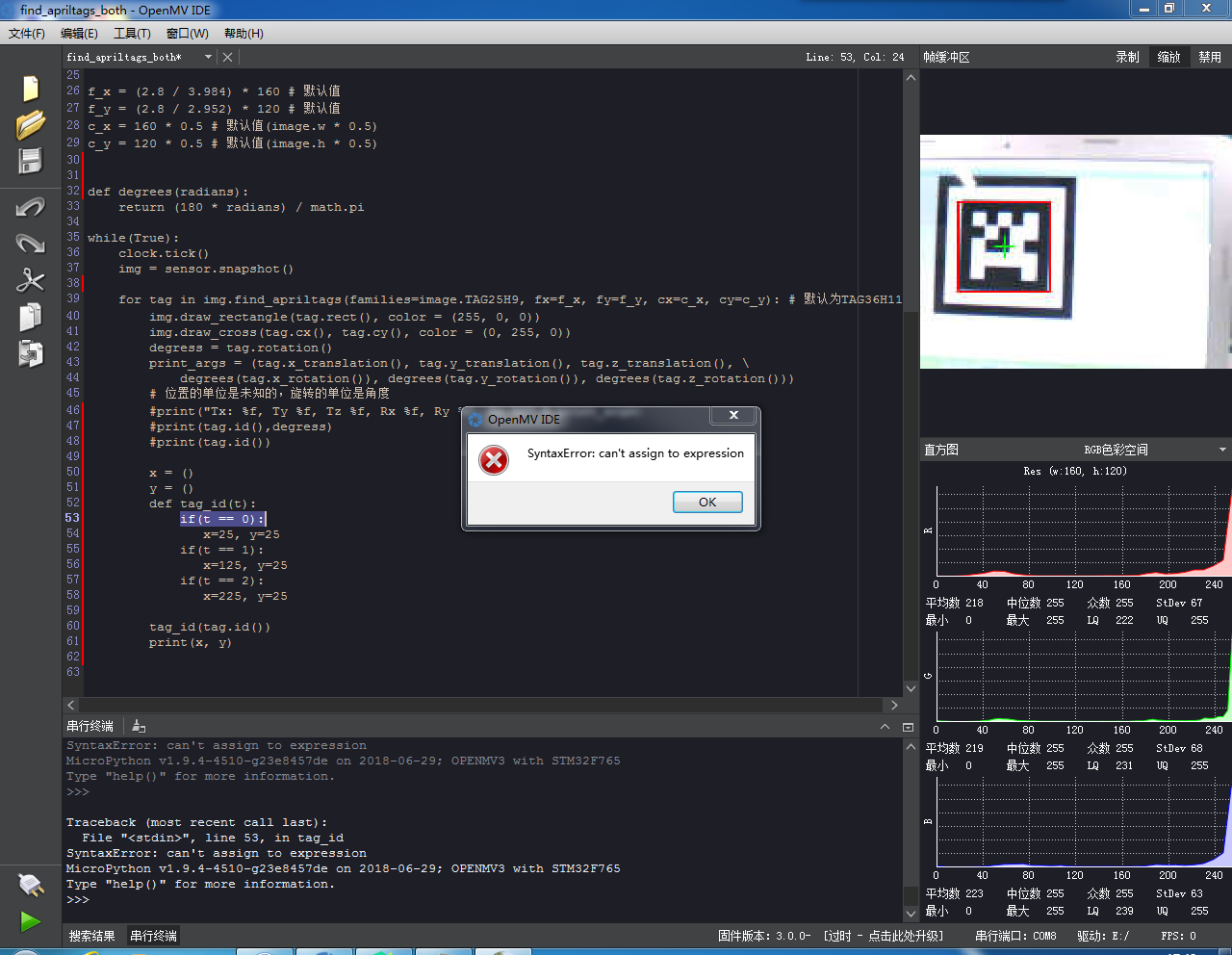
首先我在一块地图上贴了几块tag标签,并能够确定在地图上每个标签的中心点的x,y坐标,我现在想用openmv去识别地图上的标签,然后根据识别得出的不同标签代表的不同数字得到该标签的x,y坐标,再用这个x,y的坐标值进行之后的计算,现在的问题是,我不能把标签的坐标值赋值给x和y,报错说是我不能这样编写代码,下面是我的代码:

# AprilTags Example
#
# This example shows the power of the OpenMV Cam to detect April Tags
# on the OpenMV Cam M7. The M4 versions cannot detect April Tags.

import sensor, image, time, math

sensor.reset()
sensor.set_pixformat(sensor.RGB565)
sensor.set_framesize(sensor.QQVGA) # we run out of memory if the resolution is much bigger...
sensor.skip_frames(30)
sensor.set_auto_gain(False)  # must turn this off to prevent image washout...
sensor.set_auto_whitebal(False)  # must turn this off to prevent image washout...
clock = time.clock()

while(True):
    clock.tick()
    img = sensor.snapshot()
    for tag in img.find_apriltags(families=image.TAG25H9): # defaults to TAG36H11 without "families".
        img.draw_rectangle(tag.rect(), color = (255, 0, 0))
        img.draw_cross(tag.cx(), tag.cy(), color = (0, 255, 0))
        degress = 180 * tag.rotation() / math.pi
        print(tag.id(),degress)
        x = 0
        y = 0
        def tag_id(t):
               if(t == 0):
                    x=25, y=25
               if(t == 1):
                    x=125, y=25
               if(t == 2):
                    x=225, y=25
        tag_id(tag.id())
        print(x, y)


请问程序到底该怎么编写呢?
-
缩进不对,一个Tab应该是4个空格,
if(t == 0):这里有14个空格。
-
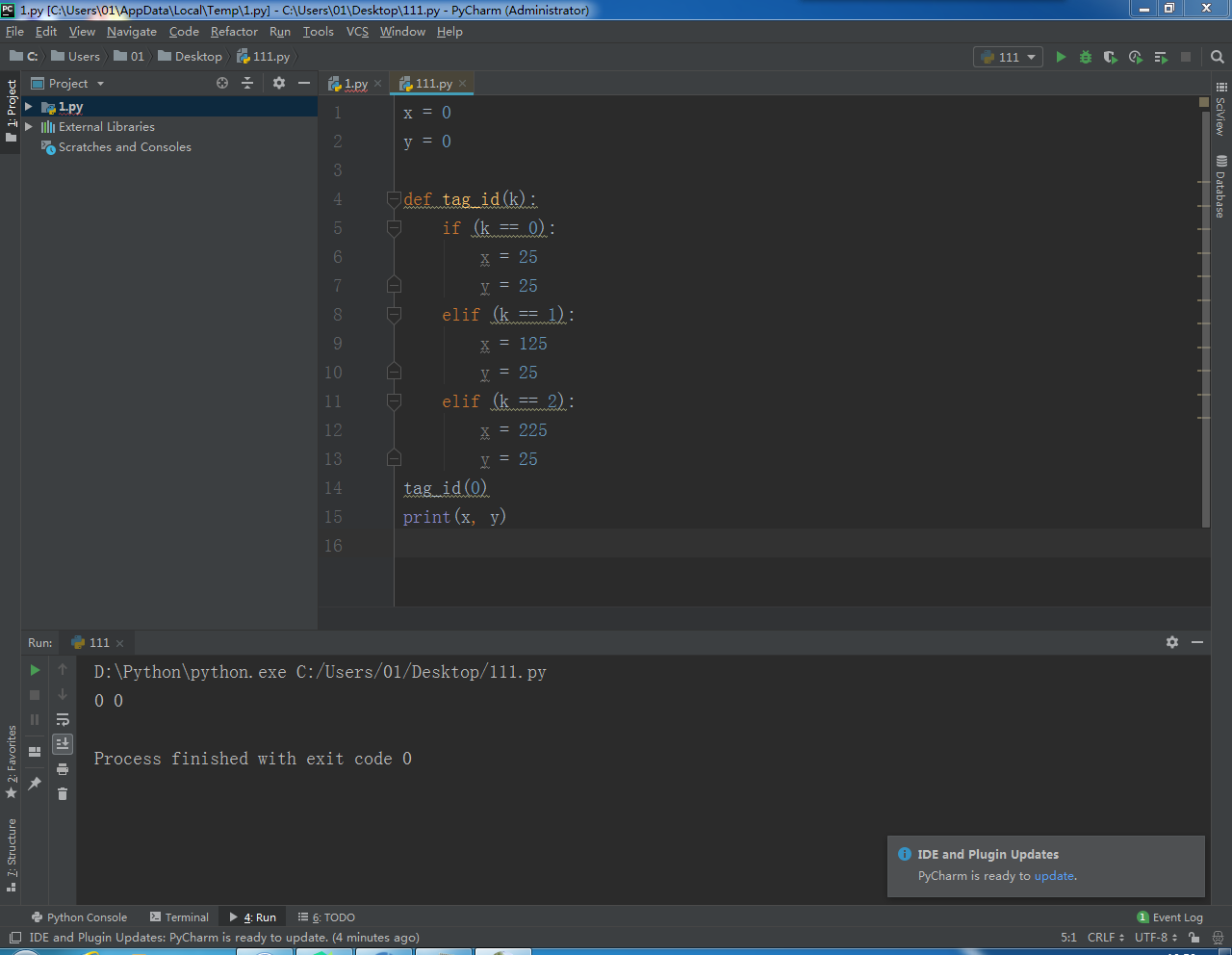
好像不是缩进的问题,我在pycharm上编译了相同的代码,也还是赋值不了,老师能帮我看看是不是其他的问题呢?

-
嘈点太多了,
1,首先定义函数不需要放在for循环里,你每秒重复定义100多次这个函数没必要。
2,x=25, y=25在python里是不能这么用的,需要两行,这也是报错的原因x=25 y=253,即使不报错逻辑也是错的,你可能不知道什么叫做全局变量,什么叫做局部变量,函数内部的局部变量x和y并不影响全局变量x和y。
4,这个函数你应该用返回值def tag_id(t): x = 0 y = 0 if(t == 0): x=25 y=25 if(t == 1): x=125 y=25 if(t == 2): x=225 y=25 return x,y print(tag_id(0)) print(tag_id(1)) print(tag_id(2))5,你的缩进实在让人看不下去。。。